8th Scottish QGIS UK user group meeting plans

It’s been a long time since we posted anything up here but hopefully the news of another user group happening in Stirling on 7th November will hopefully assuage your distress.

The event is very kindly hosted by Historic Environment Scotland in their restored Engine Shed and is also supported by Ordnance Survey, Cawdor Forestry, thinkWhere, SEPA and Registers of Scotland.

The programme is still being worked out but plan on attending one of two workshop sessions in the morning run by Ordnance Survey and thinkWhere and then a full afternoon of presentations and lightning talks.

Tickets are available through Eventbrite.

8th Scottish QGIS @UK user group

Live stream link

Here is the link to the live stream of the QGIS UK user group meeting in Edinburgh on Thursday.

Videos of the individual talks will be available after the event.

Supported and sponsored by thinkWhere, Ordnance Survey, Cawdor Forestry, EDINA (venue), WRLD3D, Angus Council, Registers of Scotland, Product Forge (streaming), OSGeo:UK (finance)

QGIS UK Edinburgh: an overview

6th Scottish QGIS UK user group meeting
Informatics Forum, University of Edinburgh, Edinburgh
3rd November 2016

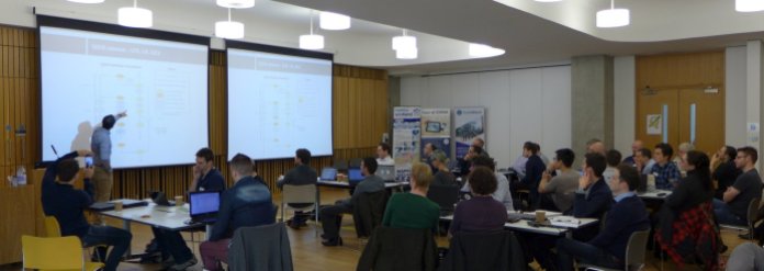
A full house with all tickets sold. Our biggest event yet. A last minute decision to video the talks. A first ever raffle to raise funds for the QGIS project. More than half the attendees were at a QGIS user group for the first time. All sectors represented and a range of talks from accessible introductions to QGIS functionality to wonderful technical geekery to varied FOSS4G use cases.

Slides

Video: https://youtu.be/kHDZmmzKU4U

How deep is your loch?
Phil Taylor (@scienceandmaps) from CEH opened up the day with a detailed explanation of how he lovingly captured the plumbed depths of four Scottish lochs and turned them into interactive 3D visualisations. You can see his results at http://contours.org.uk/bathymetry

Slides

Video: https://youtu.be/-q021mocJdI Continue reading

Notes from the QGIS-UK South West user group

Yesterday Dartmoor National Park was host to the third QGIS user group for the South West region. We a great range of talks from the worlds of academia, offshore exploration and local government to name but a few. The slides from these are below.

Teaching in QGIS

Using PostGIS within our Geospatial Workflows at Lloyd’s Register

The Adoption of QGIS at Plymouth Community Homes

Integrating QGIS functionality into a data workflow through both automated processing and a plugin

PopChange: An Academic Open Source Project

Building a Mixed GIS Environment at the Met Office

We are looking at having another meet up in the spring and are thinking of running some workshops on form designing and plugin building. Keep an eye on the main QGIS user group page on Google+ for any news.

Thanks again to everyone who attending and presented.  We also need to give a special thanks to Clear Mapping Company for sponsoring the event.

Cheers

Matt

6th QGIS UK user group meeting in Edinburgh

The 6th QGIS UK user group meeting in Scotland is happening on the 3rd November 2016.  It is being hosted by the EDINA University of Edinburgh at the Informatics Forum and is sponsored by thinkWhere, Ordnance Survey, Angus Council and Cawdor Forestry.  Tickets are available through Eventbrite.

The almost final programme of presentations and lightning talks is as follows:

  • Phil Taylor (CEH) – How deep is your loch?
  • Fiona Hemsley-Flint – QGIS server
  • University of Edinburgh – packaging and deploying QGIS
  • Anouk Lang – Mapping narrative: QGIS in the humanities classroom
  • Art Lembo (Salisbury University, MD) – terrain analysis with massively parallel processing techniques (embarrasingly so)
  • Neil Benny (thinkWhere) – finding the heart of Scotland / viewshed analysis
  • Tom Chadwin – qgis2web and coding a QGIS plugin
  • Pete Wells (Lutra) – WMTS previews and XYZ support
  • Stephen Bathgate – decision support system in Forestry
  • Tim Manners (Ordnance Survey) – Creating an indoor routable network with QGIS and pgRouting
  • Andrew Whitelee – QGIS in forestry/ecology
  • Ross McDonald (Angus Council) – Them thar hills: shaded, textured and blended
  • Michal Michalski (The Origins of Doha and Qatar Project) – DOHA: Doha Online Historical Atlas
  • eeGeo – Using QGIS to create 3D indoor maps

Doors open from 9:00. Registration shortly thereafter. Start and welcome at 9:45 and a planned finish at 16:30. Geobeers to follow.

Agenda for 5th QGIS user group – Scotland

scottish thistleThe 5th QGIS user group meeting in Scotland takes place next Wednesday at the University of Glasgow.  It is being hosted by the School of Geographical and Earth Sciences and has been generously sponsored by thinkWhere and Ordnance Survey.  You can find the draft programme of talks and presentations here: 5th-QGIS-user-group-programme

All tickets are now gone but get on the waitlist and you may be lucky.

See you all there!

FOSS4G UK

foss4guk_2016_logo

There is a FOSS4G UK conference, unconference, workshop, hackathon, code sprint and party happening in Southampton in June this year.  If you are free from the 14th to 16th then this is a fantastic opportunity to come and find out more about free and open-source software for Geo.  Have a look at the OSGeo site (http://uk.osgeo.org/foss4guk2016/) for more information.  If you want to submit a talk and/or workshop then you can do so through the site.  Early bird tickets will be going on sale tomorrow (13 April) and will be available through the site from Eventbrite.

In brief: 4th QGIS user group in Scotland

Another sold-out event with a programme packed with useful, interesting and delightful talks. Fifty seven (57!) folk blew in from all over Scotland through a freezing rain but hot coffee and pastries were waiting in the Informatics Forum at the University of Edinburgh.

First up was an overview the current status of the QGIS project by Saber from Lutra Consulting. It was good for people new to QGIS and open-source to see how the project is organised and run and the direction it is taking. Pete, also from Lutra Consulting, then gave a quick summary of the bits of core functionality they have been working on including the new ruled based labelling system.
The group then split into two for 90 minute workshop sessions on cartographic labelling and advanced Atlas usage – a tough choice! Chris, from Ordnance Survey, presented a detailed how-to on the new ruled based labelling tools using some OS open data, interspersed with some slides on guidelines to good cartographic practices and labelling tips. The slides and material for this workshop are available here: https://dl.dropboxusercontent.com/u/185489368/QGIS-Scotland2015.pdf

Heikki, from thinkWhere, lead us through the process of using Atlas in Print Composer to automate map production for a series of maps containing a main context map and an inset overview map. Nothing better than doing something once and then being able to repeat it at the click of a button! The slides and material for this workshop are available here: https://github.com/HeikkiVesanto/Scottish_QGIS_User_Workshop Continue reading

Photos from QGIS Scotland